Pointe Sable Environmental Protection Area (PSEPA)
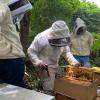
The Pointe Sable Environmental Protection Area (PSEPA) comprises various networks of interconnected systems including beaches, sea grass beds, coral reefs, dry forests, mangroves (Ma Kôtè Mangrove and Savannes Bay Mangrove) and offshore islets (Scorpion Island Marine Reserve and the Maria Islands Wildlife Reserve). These provide habitats for threatened terrestrial reptiles, marine turtles, migratory and resident land and sea birds, fish nurseries and forest products, some of which sustain livelihoods. The PSEPA is a narrow coastal strip located from Pointe De Caille to Mathurin's Point in the quarter of Vieux Fort. This 1038-hectare site was designated an environmental protection area in August 2007 under Saint Lucia’s Physical Planning and Development Act of 2001. The PSEPA consists of two Ramsar sites: Ma Kôtè Mangrove Marine Reserve and Savannes Bay Marine Reserve, which were declared “wetlands of significant value” under the Ramsar convention of 2002. Ma Kôtè Mangrove is also the largest basin-mangrove in Saint Lucia and in the Eastern Caribbean. The Maria Islands were declared a wildlife reserve in 1982, under Section 7 of the Wildlife Protection Act, 1980. This reserve is home to two critically endangered reptile species: the non-poisonous Saint Lucia Racer Snake and the Saint Lucia Whiptail Lizard. The PSEPA consists of significant historical assets and it supports a variety of activities including hiking, horse-back riding, snorkelling, kayaking, bee keeping and sea moss cultivation.


